


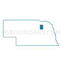
Royal Precinct, Antelope County, Nebraska
About
Outline

Summary
| Unique Area Identifier | 612421 |
| Name | Royal Precinct |
| County | Antelope County |
| State | Nebraska |
| Area (square miles) | 71.74 |
| Land Area (square miles) | 71.64 |
| Water Area (square miles) | 0.10 |
| % of Land Area | 99.86 |
| % of Water Area | 0.14 |
| Latitude of the Internal Point | 42.35906470 |
| Longtitude of the Internal Point | -98.11857790 |
Maps


Graphs
Select a template below for downloading or customizing gragh for Royal Precinct, Antelope County, Nebraska


Neighbors
Neighoring Voting District (by Name) Neighboring Voting District on the Map
- 003 CRG Precinct, Knox County, NE
- Brunswick Precinct, Antelope County, NE
- Clearwater Precinct, Antelope County, NE
- Neligh Precinct, Antelope County, NE
- Orchard Precinct, Antelope County, NE
Top 10 Neighboring County Subdivision (by Population) Neighboring County Subdivision on the Map
- Garfield township, Antelope County, NE (498)
- Ellsworth township, Antelope County, NE (249)
- Miller township, Knox County, NE (182)
- Royal township, Antelope County, NE (163)
- Frenchtown township, Antelope County, NE (159)
- Blaine township, Antelope County, NE (148)
- Eden township, Antelope County, NE (121)
- Sherman township, Antelope County, NE (103)
- Verdigris township, Antelope County, NE (78)
- Custer township, Antelope County, NE (78)
Top 10 Neighboring Place (by Population) Neighboring Place on the Map
Top 10 Neighboring Unified School District (by Population) Neighboring Unified School District on the Map
- Nebraska Unified District 1, NE (3,131)
- Neligh-Oakdale Schools, NE (2,536)
- Plainview Public Schools, NE (2,199)
- Creighton Public Schools, NE (2,072)